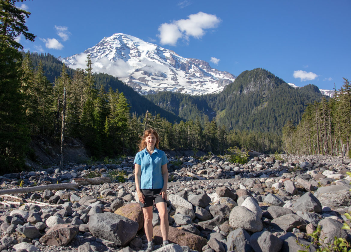
What a better way to kick off the summer season than at the incredible Mount Rainier National Park! Last year on solstice weekend, I camped with friends at Cougar Rock Campground and hiked to Carter Falls, Paradise’s Panoramic Point and Grove of the Patriarch. Read on to learn about why this is the ideal itinerary, especially for early season of Mount Rainier hiking and camping.
“Of all the fire mountains which like beacons, once blazed along the Pacific Coast, Mount Rainier is the noblest.” – John Muir
Just 2.5 hours southeast of Seattle lies this majestic playground for outdoor recreation. Mount Rainier is one of the most awe-inspiring mountains that I have ever set eyes on. Being a Seattleite, I have mused at her thousands of times from a distance. However, there is nothing like being right there in the shadows of this active volcano rising to 14, 410 feet. Mount Rainier National Park comprises 369 square miles of natural beauty. It’s part of the Pacific Ring of Fire on the Pacific Rim where our planet’s largest volcanoes and earthquakes loom and rumble.
Mt. Rainier has 5 developed areas: Longmire, Paradise, Ohanapecosh, Sunrise, Carbon River and Mowich. The Paradise area on the southside of Mt. Rainier is open all year round. At elevations over 5,000 feet, the snow doesn’t melt completely until July. Therefore, in May or June be prepared for hiking on snow. In contrast, the Sunrise area on the northeast side sits at elevations over 6,000 feet. So, at Sunrise the mountain opens only from July to late September due to more snow.
Cougar Rock Campground
This campground is conveniently located on the southwestern side of Mt. Rainier. It’s only 5 miles from Paradise, the most popular area in the park with a visitor center and lodge. At 3,180 feet elevation, it’s open from May – October for standard and RV nonelectric camping. It provides a picnic table and bathroom with running water but no showers. There’s a lookout point to see Mt. Rainier in the campground. Also, it’s walking distance to the Nisqually River, Carter Falls Trail and the well-known 93-mile Wonderland Trail, encircling the park. Here is the link for online reservations at Cougar Rock Campground.
Carter Falls Hike
Carter Falls is one of the most accessible and popular hikes for those staying at Cougar Rock Campground. Moreover, it’s a moderate 2.6 mile section of the epic Wonderland Trail, a 93-mile circuit that circumnavigates Mt. Rainier. Carter Falls hike crosses the Nisqually River on a log bridge. Then the trail climbs through the old-growth forests to Carter Falls and Madcap Falls.
Related: Top 10 Spectacular Hiking Trails at Mt Rainier National Park
Paradise
Paradise is the most popular area of Mt. Rainier at about 5,400 feet above sea level with magnificent hiking trails, waterfalls, and wildflowers. Additionally, it has the Henry M. Jackson Visitor Center and historic Paradise Inn. We trailblazed on the snowpack of the 4-mile Panoramic Point Trail from the visitor’s center in June.
We hiked up about ¾ the way for panoramic views of Mt. Adams and Mt. St. Helens and of course the starring attraction Mt. Rainier. To view these 3 majestic volcanos at once is awesome and breathtaking. Many others hiked and skied along with us. Hiking in snow has unique challenges.
Safety Tip: Be sure to stay close to the path and know how to avoid snow bridges and tree wells.
Grove of the Patriarchs
On the southeast side of Mt. Rainier, Grove of Patriarchs Trail is a wonderful way to connect with ancient trees. It’s one of the easiest trails in the park, with a mostly flat terrain on a 1.5 mile walk through old growth trees, such as, Douglas Firs, Western Hemlocks and Western Red Cedars. Also, it’s elevation is 2,200 feet (with 0 elevation gain), so it’s accessible for hiking early season without snow.
Uniquely, many of the tallest trees here became preserved for centuries because they are on an island in the middle of the Ohanapecosh River. This location helps protect them from fires. You cross a suspension bridge over the river to reach the pristine island. And don’t miss out on the twin Douglas Firs more than 1,000 years old standing right next to each other.
Related: Ultimate Guide to Mount Rainier National Park: All You Need to Know
Enjoy Mount Rainier Hiking and Camping!
It’s essential to plan in advance hikes and camping because everything fills up early, especially in July and August. Camping is a great way to be there for early hikes and outdoor activities. Remember, there is still snow in June and the wildflowers are at their peak in late July and August. Just plan ahead to ensure a safe and enjoyable trip or vacation at this incredible park.
Also, if you go to Mount Rainier in the spring, please comment below on any ideas or tips on how best to enjoy this national treasure in the springtime.


